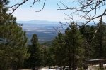
This weekend Jay and I set up our R-Pod camper at the Manzano Mountains State Campground, as a shakedown for future trips further afield. And it brought us near to four of the fine trails in the Manzano Mountains.
The Hike
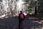
Our first hike of the weekend was up the Red Canyon trail. Parking in the lot for hikers at the Red Canyon campground, we headed uphill circumventing the campground itself with its small corrals for horses. Following what we believed was -the- trail, it soon petered out; checking the GPS we discovered that we needed to descend to the bottom of the canyon where we found a well-worn trail.
The remainder of the trail continued along the running stream, crossing back and forth numerous times. Highlights of this trail, aside from the stream, are the waterfalls, small and large; the sounds of running water add a very nice touch to the ambiance of hiking on this trail.
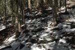
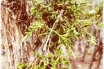
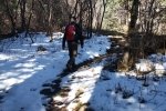
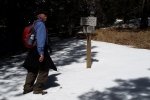
We were not too far into the hike when we encountered snow in shade along the trail, and as we got higher in elevation even found sections where the trail was covered with snow for 20 or 30 feet. Despite the snow, we found plants beginning their growing season.
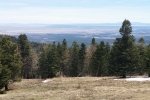
Jay here: This is one of the most picturesque hikes we’ve ever done and if you want the same experience we had, you need to do the hike in April or first week in May. The snow melt created dozens (no exaggeration) of waterfalls all along the trail. The upper portions of the hike were hard on us as they were above 9,000 feet and we were used to hiking in the Ojito wilderness all winter where the elevation varies from 5,600 to 5,900 feet. There were a lot of rest stops to get some more oxygen on this leg which I now refer to as Ibuprofen Hill.
Statistics
Total Distance: 5.31 miles
Elevation: start 7,930 ft, maximum 9,688 ft, minimum 7,930 ft
Gross gain: 1,758 ft. Aggregate ascending 2.008 ft, descending 2,008 ft
Maximum slope: 40% ascending, 41% descending, 14% average
Duration: 5:11
| GPS Track Files for Download | |
72 Downloads |
|
|---|---|
35 Downloads |
|
I urge you to explore our hiking tracks with Google Earth. With the virtual 3-dimensional presentation, achieved by panning and tilting the view, you can get a much better idea of the hikes and terrain than you can get from the 2-dimensional screenshot above. For assistance: Using Google Earth Track Files.
References
US Forest Service:
Manzano Mountain Trails (pdf)
Red Canyon Campground
ASCHG: Spruce Spring – Red Canyon Loop Hike
ondafringe: Spruce Spring/Crest/Red Canyon Trails Loop
ExploreNM: Red Canyon
AllTrails: Spruce Spring Trail to Red Canyon Trail Loop
New Mexico State Parks: Manzano Mountains State Park


